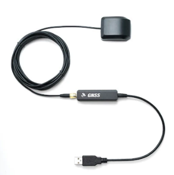
Description
Bathylogger RTK Facet Rover / Receiver kit takes a already solid platform and makes it job ready. We add a larger battery for over 25 hours of operation. 32GB storage is added and finally we seal it against water and moisture to an IP 65 Rating.
Included:
- 1x Bathylogger upgraded RTK Facet
- 1x Case
- 1x Charger and Cable
- FREE SW Maps GIS software for Android and IOS or Locus GIS software for a small charge
Designed and manufactured in Boulder, Colorado, USA, the RTK Facet is your one-stop shop for high precision geolocation and surveying needs.
The RTK Facet works with common GIS software for Android and iOS including SW Maps Android / iOS, Field Genius, SurvPC, Survey Master, Vespucci, QGIS, QField, and any GIS software that supports NMEA over Bluetooth.
Under the hood of the SparkFun RTK Facet is an ESP32 WROOM connected to a ZED-F9P as well as some peripheral hardware (LiPo fuel gauge, microSD, etc). Additionally, housed under the dome of the RTK Facet is a surveyor grade L1/L2 antenna. It is the same element found within our GNSS Multi-Band L1/L2 Surveying Antenna. The built-in antenna has an ARP of 61.4mm from the base to the measuring point of the L1 antenna and an ARP of 57.4mm to the measuring point of the L2 antenna. The RTK Facet is programmed in Arduino and can be tailored by you to fit whatever your needs may be.
This device can be used in four modes:
- GNSS Positioning (~30cm accuracy) – also known as ‘Rover’
- GNSS Positioning with RTK (1.4cm accuracy) – also known as ‘Rover with RTK Fix’
- GNSS Base Station
- GNSS Base Station NTRIP Server
At Power On the device will enter Rover or Base mode; whichever state the device was in at the last power down. When the POWER/SETUP button is pressed momentarily, a menu is presented to change the RTK Facet to Rover or Base mode. The display will indicate the change with a small car or flag icon.
In Rover mode the RTK Facet will receive L1 and L2 GNSS signals from the four constellations (GPS, GLONASS, Galileo, and BeiDou) and calculate the position based on these signals. Similar to a standard grade GPS receiver, the RTK Facet will output industry standard NMEA sentences at 4Hz and broadcast them over any paired Bluetooth® device. The end user will need to parse the NMEA sentences using commonly available mobile apps, GIS products, or embedded devices (there are many open source libraries). Unlike standard grade GPS receivers that have 2500mm accuracy, the accuracy in this mode is approximately 300mm horizontal positional accuracy.
When the device is in Rover mode and RTCM correction data is sent over Bluetooth® or into the radio port, the device will automatically enter Positioning with RTK mode. In this mode RTK Facet will receive L1/L2 signals from the antenna and correction data from a base station. The receiver will quickly (within a second) obtain RTK float, then fix. The NMEA sentences will have increased accuracy of 14mm horizontal and 10mm vertical accuracy. The RTCM correction data is most easily obtained over the Internet using a free app on your phone (see SW Maps or Lefebure NTRIP) and sent over Bluetooth® to the RTK Facet but RTCM can also be delivered over an external cellular or radio link to a 2nd RTK Facet setup as a base station.
In Base mode the device will enter Base Station mode. This is used when the device is mounted to a fixed position (like a tripod or roof). The RTK Facet will initiate a survey. After 60 to 120 seconds the survey will complete and the RTK Facet will begin transmitting RTCM correction data out the radio port. A base is often used in conjunction with a second RTK Facet (or RTK Surveyor, Express, etc) unit set to ‘Rover’ to obtain the 14mm accuracy. Said differently, the Base sits still and sends correction data to the Rover so that the Rover can output a really accurate position. You’ll create an RTK system without any other setup.
In addition to supplying position data the RTK Facet is capable of logging NMEA, RAWX, and SFRBX for post processing making it ideal for research and advanced positioning applications.